The present work investigates the mining and sale of fossiliferous Burmese amber to determine if the profits are being used by the Myanmar military to commit atrocities against minority groups or ethnic armies within the country, as recently implied. Our conclusion, based on the information available to us, is that the great majority of Burmese […]
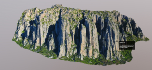
The use of GIS, remote sensing, and other geographic tools in geoconservation and geotourism is increasing. These tools – hereafter referred to as ‘Geographic Information Technology’ (GIT) tools – have the potential to simplify workflow in geoconservation assessment and inventory, be employed as decision support and decision making tools for complex decisions, or be used […]
Re-imagining the geotourism experience through the lens of slow tourism, in this paper we lay out a pathway towards a more nourishing, engaging, and educational experience that contributes to both geoconservation and a reshaping of the tourism economy in light of recent disruption caused by the Covid-19 pandemic. Evidence suggests that to date, and further […]
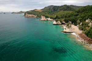
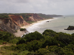
Geotouristic itineraries are important tools for the dissemination of geosciences because they work as outdoor field classes for teaching about the physical phenomena associated with the landscape in question, including the cultural one. Coastal environments are areas of great geotouristic potential precisely for this natural dynamics that give them its scientific value. The South coast […]
Nowadays, mining tourism is known as a strategy for local development and an alternative economy in remote areas. Yazd province is Iran’s mineral hub and has a high potential for promoting mining tourism. However, this form of tourism in the province has not been considered as it should. This paper emphasizes on recognizing the mining […]
The Spanish Courel Mountains UNESCO Global Geopark has strong educational and touristic resources despite limited preservation of Paleozoic invertebrate fossil assemblages within metamorphic rocks. The paleontological sites are managed by means of their inventory and integration in a Geographical Information System, the construction of virtual 3D fossil models, the creation of a fossil collection exhibition, […]
The concept of the volume is to survey all the key geoparks throughout Europe in terms of their palaeontological significance. The first 25 articles in this Part cover the long span of geological time from the Precambrian to the Permian, arranged in chronostratigraphic order. These document some of the most important early stages in the […]
Penha Garcia Ichnological Park is the most important fossil site and one of the most significant geosites of international relevance, in the territory of Naturtejo UNESCO Global Geopark. This municipal protected area is a key site for the study of trace fossil diversity at high paleolatitudes in the early stages of the Great Ordovician Biodiversification […]
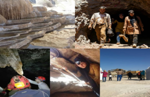
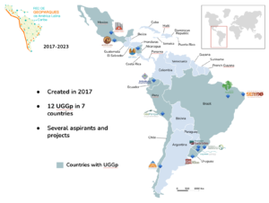
The geodiversity of Latin America and the Caribbean (LAC) is linked to the geological evolution of several tectonic units: the South American Platform, the Andean unstable areas (including the Caribbean, Northern, Central, and Southern Andes), and the Patagonian block, as well as terranes related to the North America and Pacific plates. From Argentina and Chile […]
The Azores UNESCO Global Geopark, located in the North Atlantic Ocean is a volcanic archipelago with several non-inhabited islets and nine inhabited islands. The 27 volcanic systems with polygenetic central volcanoes and volcanic ridges, most of them active but dormant, represent an exuberant geological heritage, most of which (77% of geosites) is protected. The quantity […]