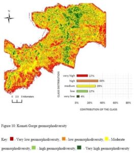
The emerging broad science of geodiversity defined in terms of geomorphological diversity assesses geomorphological features of territory by comparing them in an extrinsic and intrinsic way. This paper uses SRTM (Shuttle Radar Topographic Mission) data and GIS (Geographical Information System) techniques to assess the geomorphological diversity of Komati Gorge, in Mpumalanga Province of South Africa. […]
