skip to main content
Menu

Keyword: Geographic Information System (GIS)

Original Article
Qualitative Zoning of Groundwater to Assessment Suitable Drinking Water Using GIS Software in Mohammad Shahr, Meshkinshahr, and Mahdasht in Alborz Province

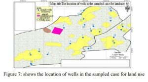
Microbiological and chemical sampling of drinking water wells in Mohammad Shahr, Meshkin Dasht and Mahdasht of Karaj was carried out. Water quality parameters were analyzed using GIS software. The results showed that the reason for the increase of sulfate could be attribution of acidic atmospheric precipitation and sulfate fertilizers. The level of magnesium in groundwater […]

Qualitative Zoning of Groundwater to Assessment Suitable Drinking Water Using GIS Software in Mohammad Shahr, Meshkinshahr, and Mahdasht in Alborz Province