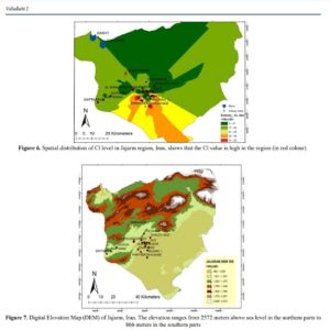
Groundwater quality data for Jajarm district was studied by using the Geographic Information System. The interpolation technique were used for the selected factors: Electric conductivity, Total dissolved substance , Total hardness, SAR, and Cl. These parameters of nearly all the wells in Jajarm district were used for the spatial analysis. In addition these parameters were […]